
Section 5.3 The Chicken-and-Egg Paradox of SLAM

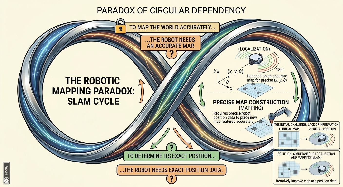
When a robot enters a completely new, uncharted environment, it faces the Simultaneous Localization and Mapping (SLAM) paradox.
The paradox runs in a circle: to build an accurate map, the robot needs to know its exact position, but to determine its exact position, the robot needs an accurate map.
Figure 5.3.1. SLAM resolves the circular dependency between localization and mapping by estimating the robot’s pose and the map together.

Subsection 5.3.1 Why SLAM is Hard: The Core Paradox

  • If you have a map: Localization is straightforward (e.g., match sensor scans to the map to figure out where you are).
  • If you know your position: Mapping is straightforward (e.g., plot sensor readings relative to your known coordinates).
  • When you have NEITHER: You must estimate both your own unknown location and the location of unknown obstacles simultaneously!

Subsection 5.3.2 Solving the Paradox: Probabilistic Co-estimation

Robots solve SLAM by treating both position and map landmarks not as single fixed numbers, but as probability distributions (uncertainty clouds).
  1. Prediction Step (Odometry): As the robot moves, its positional uncertainty cloud grows larger (due to wheel drift).
  2. Observation Step (Sensor Scan): The robot observes surrounding landmarks with sensors.
  3. Correction Step (Update): The robot compares what it expected to see against what it actually saw. It updates both its own estimated pose and the estimated positions of the landmarks, shrinking the uncertainty cloud for both!
Before scanning a landmark, the robot’s estimated position is a wide, fuzzy cloud of possible locations reflecting high uncertainty. After scanning a known landmark and comparing the expected reading to the actual one, that cloud collapses down to a small, tight region around the robot’s true position, reflecting the sharp drop in uncertainty the correction step provides.

Subsection 5.3.3 Real-World & VEX Robotics Examples

  • Real-World Example (Autonomous Mine Exploration Rovers): Deep underground mining tunnels have no GPS signals. Autonomous subterranean vehicles enter unexplored caverns without a prior map. Using SLAM, they simultaneously chart 3D tunnel structures while tracking their own trajectory to safely navigate back to the surface.
  • Real-World Example (AR/VR Headsets): Consumer augmented reality glasses use Visual SLAM (VIO) via onboard cameras to track your head movement in real time while constructing a 3D surface model of your living room furniture.
  • VEX Robotics Example (Lab 5 Autonomous Mapping): In Lab 5, your VEX robot drives through an unknown maze. As it drives, wheel encoders provide initial movement estimates while distance sensors detect maze walls. The SLAM algorithm continuously merges these noisy streams to produce a clean, accurate arena map while keeping the robot localized.
Reading Questions 5.3.4 Reading Questions

Check your understanding

1. Exercise 5.3.1: SLAM Paradox Conceptual Check.

Why is Simultaneous Localization and Mapping (SLAM) referred to as a "chicken-and-egg" problem in robotics?
  • Mapping requires GPS, whereas localization requires wheel encoders.
  • Incorrect. SLAM is designed specifically for GPS-denied environments.
  • To localize, the robot must stop moving, but to map, it must drive fast.
  • Incorrect. Motion speed is not the core paradox of SLAM.
  • Accurate mapping requires knowing the robot’s position, but accurate localization requires an existing map.
  • Correct! To build a map, the robot needs to know where it is; to know where it is, it needs a map. SLAM must solve both simultaneously.
  • Localization works only indoors, while mapping works only outdoors.
  • Incorrect. Both localization and mapping function in indoor and outdoor environments.
You have attempted of activities on this page.